Race the Wolf: Marathon

Course Description
Race the Wolf’s trail marathon takes runners on a full circuit of Schweitzer Mountain, on a roughly figure-8 route with the Village and drop bags in the middle. This is a challenging course. Do not overestimate your conditioning or underestimate the course! But we’ve designed it so that it’s achievable.
Terrain:
55% single track
38% two-track
7% off-trail
The Climbs:
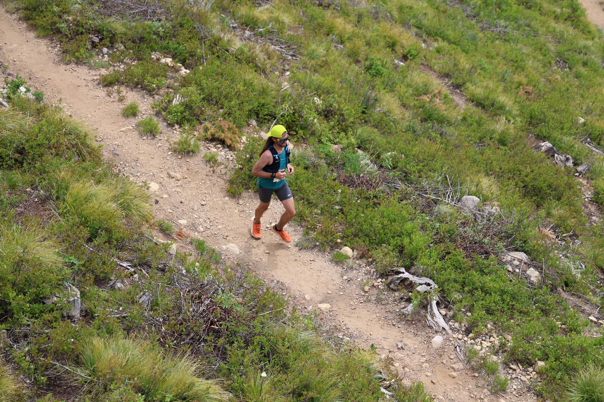
Two of the marathon’s climbs are off-trail. Surfaces are uneven with some rocks and small woody shrubs, but primarily clumped beargrass. Poles aren’t necessary but they’ll help.
Important for the Little Blue Ridge climb: Most runners will be starting the last climb during the hottest part of the day. There is no shade from the sun and on hot years temps have been in the low 90s. Be sure to refill water and snacks at the Outback before starting the climb! Similarly, if weather is inclement, you’ll be subject to rain and wind for the entire 2.5 miles. Have weather-appropriate layers ready, and refill on snacks before ascending. Most runners can expect to take 1.5–2 hours between the Outback and Sky House aid stations.
The GRIT Race Series
Race the Wolf Marathon is part of The GRIT North Idaho Trail Series. Register for and complete all of the series’ races to be eligible for cool finisher awards and bragging rights. Go Big!
Athlete Responsibility
It is the responsibility of all participants to read all emails and/or watch all videos posted with race updates and final race day instructions (check. your. spam. folder.). We send final instructions about two weeks before race day.
These races will be held rain or shine.
Course Map: Lap 1
Distance: 26.4 miles
Elevation gain: 6,272’
This is the first loop (aka the Front Side) of the marathon. After returning to the start/finish area at Mile 12.8, you’ll continue on the second loop (aka the Back Side).
You can also view the first half of the marathon on MapMyRun.
Course Map: Lap 2
The second lap of the marathon is the same course as the half marathon. Follow this to the finish line.
You can also view the second half of the marathon on MapMyRun.
Aid Stations
Mile 6.4 Highpoint-Blizzard Connector Rd - Water, soda, minimal food.
Mile 12.8 start/finish line - Water, soda, food and drop bags. Pit toilet.
Mile 19.6 Outback - Water, soda, minimal food. Bathroom.
Mile 22 Sky House - Water, soda, food. Bathroom.
Drop Bags
Drop bags are located at Mile 12.8 start/finish line.
All drop bags must be clearly labeled with your name and bib number.
Drop bag drop-off is near the start line on the morning of the race. All participants are responsible for their own drop bags. Remember to retrieve your drop bag after you finish. We do not mail forgotten drop bags.
Cutoff Times
Cutoff times are firm. Do not argue with any volunteer or ski patrol personnel. You must LEAVE the aid stations by the cutoff times listed.
1:00 pm - Mile 12.8 start/finish line. That’s 6 hours to cover 12.8 miles (28 min/mile pace).
4:00 pm - Mile 22 Sky House. That’s 3 hours to cover 9.2 miles from the halfway point (19:30 min/mile pace).
5:00 pm - Finish line closes. You must finish by this time to have an official finish. If you left the Sky House just before the 4pm cutoff, you must maintain 15 min/mile pace on the descent to the finish line.
Spectator Access
We love spectators! The easiest places to watch your competitors are:
Near the Clock Tower, where you’ll see the race start, mid-point, and finish.
Near the Sky House, approximately Mile 22. Hike-in, or buy a day lift pass.
Course description, long version
Courses will be heavily marked with obvious directional signs and flagging tape. Be sure to read and watch this year’s final instructions, so you know which color flagging to follow.
Runners need to self-support between aid stations. Carry a pack, hand-helds or belt.
First loop: From Start go 0.3 mi straight uphill to Nature Trail then stay on it until the Service Road at 1.45 miles.
Go left and stay on road straight ahead with the towers in sight. Follow marathon signage.
At 2.45 mi go right on Highpoint Trail. Stay on Highpoint singletrack trail all the way down to 6.10 and at old skid road continue left and straight for 0.3 to gravel road and Aid Station One at 6.4 miles.
Go through Gate and up gravel road and around first switchback.
In less than 100 yards take old jeep road on the right. Stay on this all the way to the summit and at Lake Side Triple there is remote water Mile 8.6.
Proceed down gravel road .55 miles to the Beargrass Trail (look for the blue barrel) Mile 9.15.
Take this down to the start/finish area, Mile 12.8 and Aid Station Two (drop bags).
Backside loop: After leaving the second aid station, go past Horse Corral (pit toilet will be on your right) and in a short distance take a left on Upper Grrrr to Huckleberry Ridge. Follow flagging and signs.
At 2 miles you will hit a dirt road. Go right 50 yards, then go left on Cloudwalker (Service Road).
Take this to the second trail on the right (unsigned) this runs parallel to the service road. Once you reach the service road again, stay on it 3.8 miles to the Outback Aid Station Three at Mile 19.6.
From here, cross the creek toward Little Blue Ridge. Begin climb straight up for 1.65 miles.
At the top (you’ll see the T-bar ski lift) go left up the ridge.
Go past the front of the Sky House. Aid Station Four is on the Wedding Platform just past the chairlift, and behind a clump of trees at Mile 22.
From here proceed down gravel road, past pond on right and take a left on Beargrass Trail again, to the finish. 26.4 miles.
